DIRECTIONS
DIRECTIONS
Point Reyes is located along the west coast of California approximately thirty miles (fifty km) north of San Francisco off of Highway 1 (see Maps). Travelers may approach the park from the winding scenic Highway 1, either northbound or southbound. Visitors can also reach the park via Sir Francis Drake Boulevard or the Point Reyes-Petaluma Road. Below are directions for the quickest routes to Point Reyes National Seashore's Bear Valley Visitor Center from the given locations.
Google Map
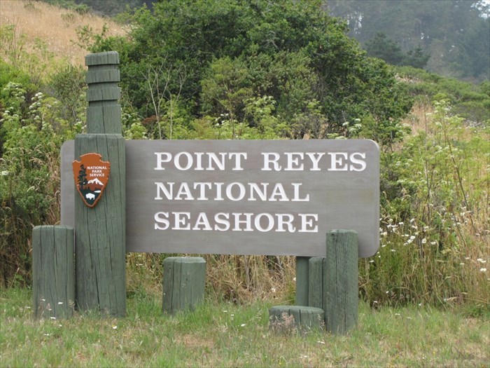
Bear Valley Picnic Area, Point Reyes National Seashore.
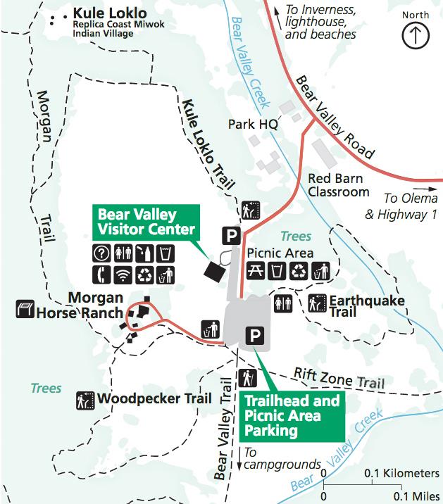
Bear Valley Map
Directions from San Francisco
-
From San Francisco, go north on U.S. Highway 101 across the Golden Gate Bridge.
-
Follow U.S. 101 about 9 miles (14 km) north of the Golden Gate Bridge to the Sir Francis Drake-San Anselmo exit, exit 450B.
-
Make sure you are in the lane for San Anselmo (the second lane from the right) and exit onto Sir Francis Drake Boulevard heading west.
-
Follow Sir Francis Drake west approximately 21 miles (33 km)—passing through San Anselmo, Fairfax and Samuel P. Taylor State Park—until it intersects with Highway 1 at Olema.
-
Turn right on Highway 1 and proceed north about 0.1 miles (0.2 km) to the intersection with Bear Valley Road.
-
Turn left onto Bear Valley Road and head west about 1/2 mile (0.8 km). Look for a big red barn on the left and a sign for "Visitor Center; Headquarters; Information" on the right with an arrow pointing left.
-
Turn left after passing by the red barn and proceed up the left-fork of the access road to the Bear Valley Visitor Center, the park's primary contact station.
Directions from the East Bay (San Francisco Bay Area)
-
Follow Interstate 580 west across the Richmond-San Rafael Bridge.
-
Shortly after the bridge, take the Sir Francis Drake Blvd. exit (the second exit after the bridge).
-
Follow Sir Francis Drake west approximately 22 miles (35 km)—passing through San Anselmo, Fairfax and Samuel P. Taylor State Park—until it intersects with Highway 1 at Olema.
-
Turn right on Highway 1 and proceed north about 0.1 miles (0.2 km) to the intersection with Bear Valley Road.
-
Turn left onto Bear Valley Road and head west about 1/2 mile (0.8 km). Look for a big red barn on the left and a sign for "Visitor Center; Headquarters; Information" on the right with an arrow pointing left.
-
Turn left after passing by the red barn and proceed up the left-fork of the access road to the Bear Valley Visitor Center, the park's primary contact station.
Directions from Sacramento
-
Follow Interstate 80 about 50 miles (80 km) west toward Vallejo.
-
Take Exit 33B to head west on California Highway 37 toward Novato/San Rafael.
-
Be sure to merge into the left lane of the off-ramp, because the right lane quickly becomes an exit lane off of Highway 37.
-
From Interstate 80, follow California Highway 37 west about 19 miles (30 km).
-
Take the Black Point/Atherton Avenue exit, which is about 1 mile (1.6 km) past the bridge over the Petaluma River. At the stop sign, turn left onto Atherton Avenue.
-
Follow Atherton Avenue west 3.2 miles (5.1 km). As the road crosses Highway 101, it becomes San Marin Drive. Continue west for about 2.5 miles (4 km) to the junction with Novato Blvd.
-
Turn right onto Novato Blvd. and proceed west for about 6 miles (10 km) to the Point Reyes-Petaluma Road.
-
Turn left and follow the Point Reyes-Petaluma Road southwest toward Point Reyes Station for about 7 miles (11 km) to the junction with Platform Bridge Road.
-
Continue straight onto Platform Bridge Road and wind your way south for 2.4 miles (3.8 km) to the junction with Sir Francis Drake Boulevard.
-
Turn right onto Sir Francis Drake Boulevard and drive west for 1.8 miles (2.9 km) to the intersection with Highway 1 at Olema.
-
Turn right on Highway 1 and proceed north about 0.1 miles (0.2 km) to the intersection with Bear Valley Road.
-
Turn left onto Bear Valley Road and head west about 1/2 mile (0.8 km). Look for a big red barn on the left and a sign for "Visitor Center; Headquarters; Information" on the right with an arrow pointing left.
-
Turn left after passing by the red barn and proceed up the left-fork of the access road to the Bear Valley Visitor Center, the park's primary contact station.
Directions from Petaluma
-
From Highway 101, take the East Washington Street exit.
-
Follow East Washington Street southwest about 0.6 miles (1 km) to Lakeville Street.
-
Turn left and proceed southeast one block to D Street.
-
Turn right onto D Street, which will become the Point Reyes-Petaluma Road, and head southwest for about 16 miles (25 km) to the junction with Platform Bridge Road.
-
Continue straight onto Platform Bridge Road and wind your way south for 2.4 miles (3.8 km) to the junction with Sir Francis Drake Boulevard.
-
Turn right onto Sir Francis Drake Boulevard and drive west for 1.8 miles (2.9 km) to the intersection with Highway 1 at Olema.
-
Turn right on Highway 1 and proceed north about 0.1 miles (0.2 km) to the intersection with Bear Valley Road.
-
Turn left onto Bear Valley Road and head west about 1/2 mile (0.8 km). Look for a big red barn on the left and a sign for "Visitor Center; Headquarters; Information" on the right with an arrow pointing left.
-
Turn left after passing by the red barn and proceed up the left-fork of the access road to the Bear Valley Visitor Center, the park's primary contact station.
Directions Using GPS or Internet Mapping Applications
If you can enter a location into your GPS unit based on the location's latitudinal and longitudinal geographic coordinates, use either the decimal degrees (DD) or degrees, minutes, and seconds (DMS) coordinates listed below.
Bear Valley Visitor Center:
DD: 38.0412, -122.8002
DMS: 38° 2' 26" N, 122° 47' 59" W
75 Bear Valley Road, Point Reyes Station, CA 94956 (Bing Maps)
1 Bear Valley Road, Point Reyes Station, CA 94956 (Google Maps)
GM: "Bear Valley Visitor Center"